The Arncliffe Circular – a high loop across limestone country in the Dales
- timbarber
- Jul 20, 2025
- 6 min read
I’d logged this as a potential walk when I was recovering from my hip replacement in January, so I always saw this hike as something to work up to as I regained fitness and stamina. The original loop was plotted by Jonathan Smith on his great www.where2walk.co.uk Website, but I decided to add a little bit on my route to make the overall length 10.14 miles, with 1408 feet of climbing.
So after completing some shorter walks and building up fitness with some speed walking on The Chevin, myself and my wife Liz took the day off on a Friday and headed into Littondale.
Littondale is a lovely little Dale which can be accessed from Wharfedale near Kilnsey Crag or from the high road over Malham Moor. The start point of the walk was the small village of Arncliffe with the quirkly little pub The Falcon Inn sitting on the village green. I often make a stop here on my All Creatures Great & Small Tours as Arncliffe actually plays part of Darrowby in the new TV series and the back of Skeldale House.


We parked outside The Falcon Inn and with our black lab Bronte as companion, started the walk which follows a footpath sign along a track just to the right of The Falcon Inn. I had plotted the route in my OS Maps App and knew that the first hour was going to be the worst part of the walk as the track starts to rise and rise until reaching the high point on Yew Cogar Scar.

The path started pretty flat for the first quarter of a mile, following a dry stone walled track lined with red flowering rose bay willow herbs.

This track gradually started to ascend and is actually an old drovers road, known locally as Monks Road, where during medieval times the lay brother monks would drive (or drove) their sheep across the high moors to summer pasture. It’s where The Drovers Arms in All Creatures gets its name from!.

Whilst you could see the path went upwards, it was one of those walks where you only got to see the next high point when you reached the one before. So every time you felt you had reached the top, you ended up with a bit more to do!

What made this stretch more bearable was stopping every so often to take in the wonderful views back into the pretty village of Arncliffe.

There were also amazing views of further down Littondale with a patchwork quilt of fields separated by dry stone walls.

Yew Cogar Scar is a limestone cliff on the edge of a narrow V shaped valley between Darnbrook Fell and Malham Moor. Unlike the great U shaped valleys in the Dales carved out by glaciers, this V shaped valley was carved out by fast flowing glacial meltwaters running beneath the glacier as it retreated.

The scar follows Cowside Beck in the valley bottom and has great views into the narrow cleft.
I often drive on the road on the other side of the valley, where you can see caves and holes in the cliff face where lead was mined in the 1700’s and 1800’s.

The path follows the top of the scar with the occasional side valley connecting at right angles, often with dry stone walls running along the fellside back into the valley bottom.

We were now walking across limestone country, passing small areas of limestone pavement, similar to that found at the top of Malham Cove.

Eventually the path veers off to the left away from the scar passing a limestone outcrop called Clowder.
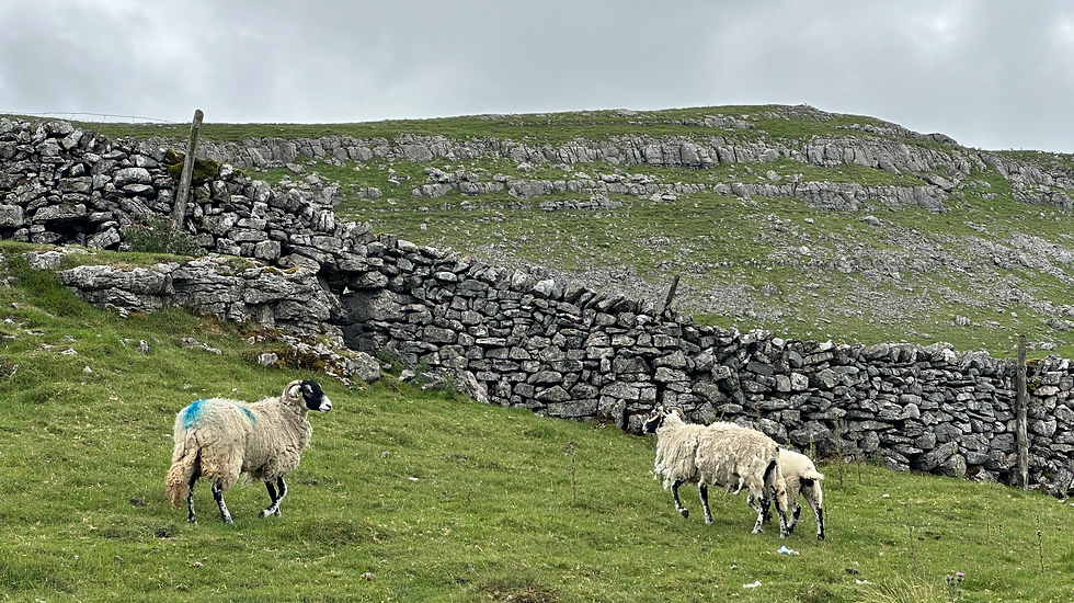
The path is relatively flat with a few short stretches of ups and downs. There were lots of limestone crags, drystone walls and sheep. Looking at the map there were listed lots of former settlements dating back to ancient times.
We eventually came to a farm, known as Middle House. The track passed the right of the farm building.

I couldn’t help notice the thickness of the moss which had built up on the Yorkshire stone roof, which I guess would be providing some reasonable insulation.


Our route then opened up across even more of this limestone landscape – often known as a “Karst” landscape, with more sheep and limestone pavement. You may remember from your Geography lessons at school that the cracks are called “grykes” and the blocks between are known as “clints”.

It was funny just seeing an old cast iron bath tub up here in the middle of nowhere! A farmer had obviously though rather than scrapping it, he would re-purpose it for providing water for his sheep. I decided against going for a quick dip.

Whilst the weather had been dry but muggy to start out, we did end up starting to get some showers as we were quite high up here.

We walked past another farm known as Middle House before veering left over a large area of Moor known as Great Close.
At the farm there is a path where you could take a detour there and back to Malham Tarm. We considered this, but as it was raining and we still had 6 miles to walk, we decided to stick with the original plan.

On the map, I noticed a bronze age stone circle listed in this area. I always like a bit of ancient stone bothering, so following a bearing I found it in the mist and drizzle. Hard to think people lived up here and would have used the location for ceremonial purposes about 6,000 years ago ( it would have been warmer then by the way!).
Having bagged the stone circle we continued on. We had set off at 10.05am and had agreed we would get 3 hours under our belts before lunch.
The path eventually hit a crossroads on the moor at Street Gate and we turned left along Gordale Beck. This is the same stream that runs into Malham Tarn and then out and down the famous Gordale Scar near Malham.
After a relatively easy, flat section the path goes off to the left with some minor ascent up to a point called High Lineseed Head. From here we got our first glimpse back into Littondale.

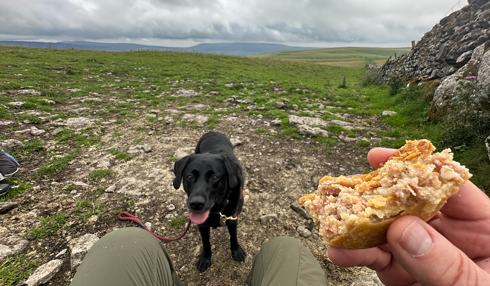
The map showed that the walk from here on to Arncliffe Cote was all downhill. As it had just turned 1pm we stopped for our lunch with Bronte sharing my pork pie and hoping for a share of Liz’s sandwich.


On the horizon was a really interesting stone formation – called an erratic, where a stone had been deposited by a glacier on top of another stone looking like it was balancing precariously.
After lunch, the path descended across High Cote Moor, on a tongue running along the site of Cote Beck. This was another steep V shaped valley.
On this section of the walk we were serenaded on our journey by a large number of meadow pipits – a ground nesting bird with a distinctive song.


There were also some obvious drumlins – another type of rounded glacial deposits I am sure many will remember from school level geography lessons!

The path eventually dropped us into Arncliffe Cote, a small farmstead on the main road into Littondale.


Arncliffe Cote is still a couple of miles from Arncliffe village itself. Having not done a decent walk for 12 months because of my hip, my legs were feeling very tired as we walked down the road away from Arncliffe before taking a little side road down to the River Skirfare.
Here we picked up a riverside path which was so beautiful following the meandering river it took my mind of my aching limbs.

Bronte had a quick dip in the river to cool down before we walked along the path and through fields, past field barns and old stiles towards Arncliffe.


At one point on the river, the meander had created quite a steep riverside cliff where large numbers of sand martins were nesting in holes. It was interesting seeing all the rounded stones which had been exposed which had been deposited after the last ice age when a glacier retreated.

Eventually we came off the path at St.Oswald’s Church on the edge of Arncliffe. This was the church where they used the outside for the filming of James and Helen’s wedding in the new series of All Creatures Great & Small.


From here it was a short walk back into the village where The Falcon Inn beckoned us for a pint. I had a lovely Timothy Taylors Golden Best, which hardly touched the sides.

I felt it was well deserved and whilst I was very stiff the next day, it was great to know that my hip replacement meant that I can get back to doing some proper hikes again. A few more stamina building walks and I will be able to try and bag my last two of the #Yorkshire30 – Yorkshire’s 30 highest peaks which I had to put on hold 18 months ago.
For anyone wanting to try the Arncliffe Circular – check out instructions on the Where2Walk website - https://where2walk.co.uk/walk/arncliffe-circular-walk/


Comments