Baugh Fell – a difficult hike up the twelfth highest peak of the #YorkshireDales30
- timbarber
- May 2, 2023
- 4 min read
Updated: May 3, 2023

I’m gradually working my way through the #Yorkshire30 – the 30 Highest Peaks in the Yorkshire Dales National Park. Whilst with boundary changes some of the peaks are outside of what is defined as Yorkshire now, at one time they all were in the county.

I’m doing the challenge with my old pal McFet who I used to play rugby with . We had completed our 24th peak back in January, but hadn’t had a free day to tick off number 25 until last week in late April.
5 of the last 6 are in the Howgills, but we still had one to do in what is classed as in the Cumbrian Pennines now. That peak was Baugh Fell and at 678 metres (2,224 feet) it is the 12th highest on the list.
We are using Jonathan Smith from Where2Walk’s great book for planning our routes, but were warned in its notes that it was a difficult climb, partly because much of the walk is over featureless moorland with no paths.
He describes Baugh Fell as an “undoubted beast of a mountain” and states “There are no rights of way beyond the lower slopes. As a result it is only visited by the lonely fanatic and sadistic instructors on Duke of Edinburgh training. In fact I know the army find it a good training ground”.
We knew we had to do it one day so chose a long route up from Rathnay Bridge. There was a parking area close to the bridge which lies on the A683 on the road between Sedbergh and Kirkby Stephen.
The walk starts off following a footpath through a number of isolated farms such as Eller Hill, New House & Needle House along the River Rathnay.

With just 20 minutes gone of the walk there were already fabulous views.

There were lots of sheep and their new born lambs frolicking in the fields.

It always makes a good picture to find a bit of rusted farm machinery lying in a field.

Some of the route was along rough tracks between dry stone walls between the farms or across fields of sheep.

Finally the walk meets up with the Pennine Journey footpath in a little area of woodland after crossing a beck on a small wooden bridge. From here the path is relatively easy to follow up for the first mile or so before it gradually visibly disappears! It is worth making sure you have OS Maps on your phone and have download the Where 2 Walk GPX file for the route, as the final stage is just a case of making your way along the valley side as best you can staying as close to the route as you can.

We got about 10 minutes of blue sky along this stretch before it clouded over for the rest of the day!


When you meet the 400m contour line at Raththay Gill Foot the valley splits and the climbs starts. There are a few options we could have taken – a scramble up Rawthay Gill or just taking a bearing and marching up to Gill Head in a straight line.
We decided instead to take a bearing on the right side of the gill to West Baugh Fell Tarn and just head up.


This stretch was a killer as we climbed straight up with a couple of stops to catch our breath.
We saw a lot of voles on the hill side but they were way too quick to get a photo of, but we dis see a beautiful green common lizard.


Upon reaching the summit top which is relatively flat we could see some cairns in the distance which we headed towards.


By following these cairns it eventually took us to a Trig Point at Knoutberry Haw – which is at 676 meters


There were great views from the Trig Point.

From what we had read, many people think this is the summit – sadly it is not. The actual summit is at Tarn Rigg Hill and is a kilometre further east. Walking along a wall through peat hags and past a series of small tarns known as the East Tarns we finally arrived. It had taken 4 and a half hours to get to the summit and we decided it was time for our packed lunch.

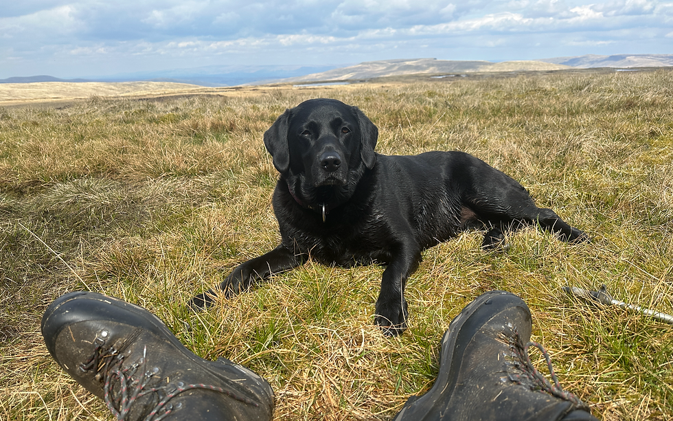
My black lab who is usually never lacking energy, sat down and had a rest at this point.
With a sandwich, pork pie and flask of tea inside me and obligatory photos we started the return journey.
This involved retracing our steps back to the point on the summit area where we had arrived after our climb up.

When we reached this point it was a case of taking bearings straight off the fell side to get us back almost to the car park. This was a tricky job as our bearings had to draw straight lines to miss the gills running down the fellside to avoid lots wetter terrain as well as ups and downs.
Once we had the bearing it was a case of keeping on these lines as best we could. The GPS on the phone really came into its own on this section.

I do not think I can remember a harder descent and I ended up with a couple of cramp attacks in my legs coming down. I also found my first blister in almost a decade!
The reason for this was the difficulty of the terrain, a mixture of tussocks, long marsh grass and wet bog. Every step required you to lift you leg up high or pull your foot out of bog where your boot had sunk in. The effort taken with each step was really energy sapping.

Whilst we were descending, the views of the Howgill Fells were absolutely outstanding and helped take our mind off our aching limbs!

We could see the car from 2 miles away and as we got closer we eventually met a path which took us east for a quarter of a mile before finding some deep 4x4 tracks which we followed to the car.

It had been one of the toughest days walking as part of this challenge and our couple of pints in the Moorcock Inn in Austwick on the way home were well deserved!
If anyone is thinking of attempting this peak, I would definitely make sure you have a map and compass as well as OS Maps (map downloaded before setting off) as navigation is definitely key to bagging this one. A battery power pack would be useful too in case your phone runs out of charge.
Well another one ticked off – 5 more to go!


Comments