Walking the Six Dales Trail – 38 miles between Otley and Middleham
- timbarber
- Jul 4, 2023
- 11 min read
Updated: Jul 5, 2023

I had heard what a great walk this was from a couple of friends who had both walked the 6 Dales Trail, so myself and my wife took a couple of days break, booked accommodation and decided to set off for this challenging walk.

Before, going into my experience of the walk with some photos from the trail, it is worth explaining a bit about how the walk came about. It was devised by a small group from Otley Walkers are Welcome with John Sparshatt – the author of the guide as a key player. As well as devising the route they also raised funding from bodies such as the Long Distance Walker’s Association and Nidderdale Area of Outstanding Natural Beauty to sign the route.
The route first launched in 2010 and is called the 6 Dales trail because the route takes in Wharfedale, Washburndale, Nidderdale, Colsterdale, Coverdale and Wensleydale.

The 38 mile route can be split into two sections (or more) with many people choosing to stay in Pateley Bridge at the end of day 1. As we had our black lab Bronte with us, we chose to walk an extra couple of miles on the first day and stay in Wath at The Sportsman’s Arms which was dog friendly.
Whilst you walk over 5 watersheds between valleys, the climbs are not particularly hard, it is just walking approximately 20 miles a day requires a certain level of fitness and no matter how keen a walker you are, your legs will be tired at the end of each day.

We were dropped off on Day 1 at 7.30am in Otley and made our way to the Medieval Bridge over the River Wharfe. The route is signed with a green road sign.
We followed the track through a housing estate and past the Otley hospital on the right. Eventually we left the houses behind and started walking gently uphill through farmland up towards the little village of Clifton.


Interestingly apparently Oliver Cromwell marched his troops through the village on the way to the Battle of Marston Moor and a number of the houses date to the 1600’s including the wonderful Old Hall Farm.

From Clifton we walked over Newall Carr Road and over towards Farnley Moor. Silage bags with recently cut grass appeared in one field looking like a weird modern art installation.


On our map it showed an ancient burial mound which came into view on our left hand side. These often dates to the bronze age and would have at one point contained the body of a person of importance from the area from about 4,000 years ago!

The Dob Park Estateplaque sitting on an old mill stone as be entered the estate.


The path eventually joins the road for a short stretch before descending down into the River Washburn at the historic Dob Park Packhorse Bridge. This narrow bridge is grade II listed and is believed to date to the 1600’s with later repairs in the 1700’s. It was important for trade in the days before toll roads and was built to help horses with paniers cross the river in the days before cars and trains.

There was no need to cross the bridge, so we turned left and followed the river for a short while.


Eventually the path meets Swinsty Moor Plantation and drops down into the wood towards Swinsty Hall.

The 16th Century Manor House was bought for £3.75 million by England Football manager Gareth Southgate and has 6 bedrooms and its own cinema.

From here we walked along the side of a Swinsty Reservoir until we met the Fewston Embankment Dam Wall. We had made good progress, weather was good, so we stopped in the car park to use the toilets and have a short rest grabbing some tea and flapjack.
The next stretch of the walk was along a flat easy path which follows the bank of Fewston Reservoir.


Both Swinsty and Fewston Reservoirs were built in Victorian times to supply clean water to the industrial City of Leeds.

At the end of the reservoir the distinctive shape of St. Andrew’s Church at Blubberhouses comes into view. The church was designed by Edward Buckton Lamb who had a reputation as a “lone gothic revivalist” whose work was either loved to hated. Pevsner the architectural historian describes Buckton Lamb as “the most original but not the most accomplished architect”!.

When I take American guests on tour they always laugh at the name Blubberhouses but sadly its nothing to do with whales or overweight people, its name comes from the Anglo Saxon “houses near the bubbling stream”.
We crossed the busy A59 road which in 2014 was one of the King of the Mountain stages of the Grand Depart of the Tour de France (known as Cote de Buttertubs).


We then dropped into a wood and followed the River Washburn for a couple of miles in some lovely shade. Our dog Bronte was in and out of the river again and again along this stretch but the path was good and we made good progress.

Eventually the beast came into view! By the beast I mean the Reservoir wall where the River Washburn was dammed to form Gouthwaite Reservoir behind it. The path followed the valley side as we walked up the side of the valley from the bottom up the reservoir wall.

After crossing the wall there were great views down the Washburn Valley and back over Gouthwaite Reservoir. From here we started a slow and steady climb out of the valley along a road for a good stretch.


We climbed up onto some moorland and then followed the path over to an old Water Tower at the main Greenhow Hill Road.

Walking so far had been pretty easy but this changed for the next few miles.
We started walking through farmland with either recently cut grass or long grass heading over towards Padside village where we had decided that we would have lunch.


We started to have to walk through stiles which are always a bit of a challenge for me having no knee ligaments in my right knee after a car crash and a half knee replacement in the other.
After a 20 minute rest in Padside - a quaint hamlet of stone cottages, and having replacing some of those lost calories, we headed off for the final stretch of the walk. We had been walking at 2.5 miles – 3 miles an hour pace up to now, but the next hour dropped down to just over 1 mile an hour pace.

It was as though the farmers have deliberately created the most user un-friendly stiles for a laugh. We encountered wobbly wooden stiles with nothing to hold onto, barbed wire topped styles, stiles with slate cemented into the gap in the wall, and even an electric fence over one stile which I almost had to fosberry flop over as it was too high. Needless to say I went flying, but escaped without electrocuting my nether regions.


Gradually the path climbed up past Heyshaw and onto Heyshaw Moor. It is here that wonderful vistas down Nidderdale start to come into view.

The heather doesn’t usually start to bloom on the Moors in Yorkshire usually until August, but with the fine weather we have been having the bell heather was in bloom in places making the views even more stunning.

We skirted around the edge of the heather moorland with bracken and billberry and into Guisecliff Woods.

The path descends steeply through the woods as we dropped down into the valley bottom in Nidderdale. The wood contained lots of huge millstone grit outcrops deposited later in the carboniferous 320 million years ago. The woods were quite difficult to navigate through as a number of the paths detailed on the 6 Dales route were heavily overgrown with bracken.
The path eventually came out in the village of Glasshouses.

As we descended we could see the large 19th century mill which has now been transformed into luxury apartments. The Mill was built in 1820 and was originally a cotton mill before changing into a flax mill and later made rope from hemp. It is said that the mill supplied the rope for the ill-fated Titanic. The mill is now grade II listed and has retained its impressive clock tower.
We stopped in Glasshouses to catch our breath – knowing the rest of our day's journey would be on the flat along the River Nidd.
We crossed Glasshouses Bridge and turned left passing a small lake which had formed in front of a weir. There was an outward bounds session going on with lots of kids having fun paddle boarding.


We yomped down the riverside to the North Yorkshire market town of Pateley Bridge. A picture postcard town with independent shops, two great butchers and numerous tea rooms (it also has the World’s oldest sweet shop according to the Guinness Book of Records).

We didn’t stop here apart from taking a quick picture up the high street. After crossing the road we followed signs for the Six Dales Trail and Nidderdale Way continuing along the riverside.
This last stretch was just under two miles of walking along riverside meadows with lovely views down the Dale.


We eventually could see the village of Wath and after crossing a small footbridge, we walked up the road to The Sportsman’s Arms. The sun was out and we celebrated the first days walking with a well-earned pint outside.


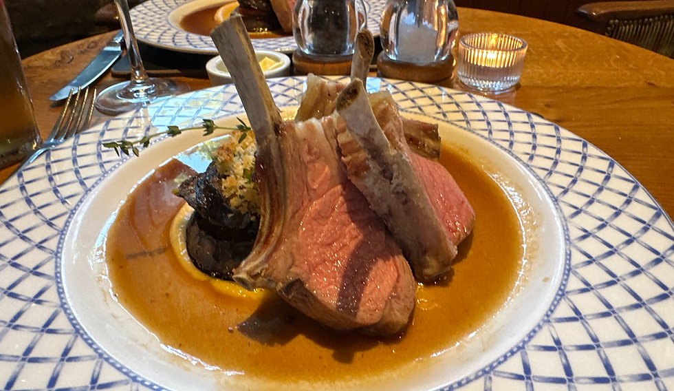
The pub has great rooms and some are dog friendly. We showered and had a hearty meal in the bar of Nidderdale lamb.
I checked my Fitbit and found the day had taken 9 hours and 15 minutes and I had walked 52,039 steps!

After an early night with a good night’s sleep we got up and had a hearty breakfast in the pub before setting off at about 8.50am.
After the blue skies of the previous day, today was colder and over cast.


Stretch one of this mornings walk was a short walk along the river to Gouthwaite Reservoir. Unlike Swinsty and Fewston, Nidderdale’s reservoirs were built by the Bradford Water Company to provide clean water for Bradford as opposed to Leeds. The city was full of disease due to overcrowding and heavy industrialisation so clean water from the Dales helped with the reduction of diseases at the time such as typhoid and cholera.
We passed Gouthwaite Reservoir wall where repair works were going on which echoes down the Dale.

We walked along the edge of Gouthwaite on the flat, knowing that at some point we would end up in Bouthwaite just outside Ramsgill where our climbing would start.

At Bouthwaite there is an obvious track on the right which starts to climb out of the village. This is a steady climb and one of the steeper ones on the trail. It is worth keeping on looking back at the views of where you have come from as the views back are stunning even without the blue skies.

We ended up reaching the moors and were met with thick mist and visibility dropped. The views were still great but we just couldn't see as far.

It started to rain as well at this time as we reached a fork in the path, taking the left path onto Fountains Earth Moor. Up on the moor we kept on being passed by groups of men on trail bikes which kept disturbing the peace, but they looked to be having fun.
The Six Dales Trail guide book talked about great views down across The Vale of York and the Hambleton Hills, sadly we could see about 30 yards.
The walking from here starts to get more difficult. We followed the moorland track which was a bit more rocky underfoot.

We could just about make out the rocks known locally as Jenny twigg and her Daughter to our left on the brow of the valley top.

Eventually we came to a series of rock outcrops called Coomb Crags where there was a couple of shooting houses built into the rocks. We sheltered here from the rain, had some of our flask of tea and treated ourselves to some fruity flapjack.


The path descended from the Moors down to the valley bottom skirting the bottom of Roundhill Reservoir.

The path then immediately ascends up to Pott Moor High Road – climbing over field after field and having to deal with a stile through every dry stone wall.
No sooner had we got up to the top of the valley side we had to descend again, descending very steeply through the bracken on the valley side and later a wood down to the edge of Leighton Reservoir at High Sourmire.


This descent was through a very overgrown section of bracken with a young oak tree plantation making navigation and following paths difficult.


The next stretch was also demanding as we crossed a bridge and marched back up the valley side with Ox Close Plantation on our right before dropping back down into the little village of Gollinglith Foot.

We decided this was a good place for lunch as the drizzle had stopped temporarily. This was a well earned short rest as the lactic acid from the day was building up and we knew we had quite a few more miles left.

The drizzle started again so we decided to crack on. We climbed a rough track which rose quite steeply, walking through Agra Crags plantation up onto the Moors.
This moor was less the heather moorland we had seen the previous day and more rough scrub. It was very boggy and we had to watch where we were putting out feet all the time making small detours from the path onto drier ground.


Whilst this bit was tough, there were a lot of oyster catchers with their distinctive red beaks and curlews with their long curved beaks that were flying around the trail which was fascinating to watch as we made slow progress across the Moor.

Eventually we met Ellerstring Plantation and followed a path along the side of the trees in to Ellerstring. There was an old boundary stone built in the wall telling us we were in Mashamshire.

From Ellerstring we made good progress – following the edge of some wheat fields down into High Jervaulx, coming out at Byrnmoor Ice cream.

Our first view of Wensleydale down a narrow hedge lined track with rose bay willow herb providing a nice splash of red.

We met a walkers group of 20 people from Otley who were leaving Brynmoor on the same route to Middleham we were taking and we became stuck behind them for a mile stretch along a narrow fenced off section. They kept stopping to stroke cows which was frustrating! We managed to excuse ourselves and sneaked past them crossing the road at the junction of Jervaulx Park.


We continued through the park, passing the stunning ruins of the former Cistercian Abbey of Jervaulx. This was one of the most important abbeys in the area once before Henry VIII’s dissolution of the monasteries. The Abbey name roughly translating as Jer coming from Ure as wensleydale is the Valley of the River Ure & Vaulx meaning Valley - so essentially it is the Ure Valley Abbey.
After walking through the Abbey grounds we met the main road for a while before taking a path down to the river past a maize field .The next stretch was a river walk along the Use in Wensleydale for 2 miles down to the Cover Bridge.

We had made slow progress for the last few hours, so on a flat riverside path we picked up the pace and boshed out this section in about 40 minutes.

We came out at the Cover Bridge, knowing we only had 2 miles left and seeing a pub – the Cover Bridge Inn, we treated ourselves to a quick drink to help re-hydrate and sustain us for our final hours walking.

After our pub stop, we found a gap in the wall next to the pub taking us down to the River Cover. The next stretch took us along the river into Coverdale our 6th Dale.

It was now that we felt pretty drained and had started to stiffen up. It was a lovely walk along the river but all we could think about now was getting to our final destination.
The path along the river rose up and then dropped down again in a slightly demoralising way until we came to a path where we climbed up and out of Coverdale.
Eventually we met a field and continued walking up to the brow of the hill past a race horse training track.
When we got there we could finally see the ruins of Middleham Castle – once the childhood home of Richard III. This was a great view and we followed the track down back into Wensleydale and past the Castle into the town.


We had booked into a dog friendly room at the Richard III pub, we ended up being in the Richard III room and found out the next day there was a Richard III Festival at the Castle.

We had a quick drink, showered and then headed down for a few pints of Wensleydale Brewery Richard III Ale and a hearty meal of Trio of Nidderdale sausages and mash.

The walk was longer than I expected and I had walked another 51,152 steps today making it 100K plus for the two days. Our split for distance was roughly 20 miles on Day 1, but only 18 on Day 2. But Day 2 was much harder terrain, harder to navigate and had way more ups and downs.
Still it was a beautiful walk, even with the inclement weather on day 2. Lots of different landscapes, wildlife and challenges. There was an immense feeling of satisfaction upon finishing but I think my knees may take a week or two to recover!
For more information on the Six dales Trail – visit https://www.wawotley.org.uk/six-dales-trail/


Comments