Ilkley to The Doubler Stones loop walk
- timbarber
- Feb 7, 2021
- 4 min read

This is a good lockdown leg stretch with a few short climbs to get your lungs going. A pal of mine Lee from Burnley (over on the Darkside) who lives in Leeds was my exercise companion for the day, after taking the `Friday off work for his 56th birthday (I know he looks a lot older!)
We parked up at the bottom of Heber’s Ghyll in Ilkley and started our ascent up onto the Moor.

We followed the path up along the side Heber’s Ghyll formerly known as Black Beck through the ancient woodland. The beck was full and flowing quickly, the noise at times quite deafening. This is a great way up onto the Moors but a very steep climb where the path zig-zags the beck over small bridges.
Heber’s Ghyll was re-named in Victorian times after Bishop Reginald Heber who was responsible for writing many hymns apparently. The area was very popular for health walks and promenading during Ilkley’s time as a popular, Victorian Spa resort for the wealthy and attracted visitors such as Charles Darwin to come and take hydrotherapy treatments in the many Spa hotels.
Once through the gate as the woodland ended and Rombald’s Moor began, we took a right turn along a muddy path, bringing us out at the Swastika Stone.
I’ve walked up here many times and the views down Wharfedale from here are stunning. Today we had a pea souper, and the visibility was down to about 10ft with thick mist destroying any chance of a view.

Here is a view from between Christmas and New Year to show you

The swastika stone is an ancient rock marking dating back to the bronze age. There are railings around the carving to protect it and as well as the original which is very well worn now, beneath it on a different rock a later version was carved out during the Victorian era.

The swastika stone shape bears no resemblance to the Nazi insignia and it was believed that this ancient stone carving resembles Celtic art relating to the sun and was actually also a symbol of peace. It is now used as the logo for Ilkley Rugby Club.

We continued through the mist along the edge of the Moor until we reached a cairn of stones at this point we took a muddy track off to our left. The sun just started to make an appearance through the cloud giving the landscape an earie glow.
After about half a mile we passed through a stile and the mist started to clear. On the horizon we could just make out the silhouette of The Doubler Stones on the horizon. We followed the path through a gate and made our way up to the stones.

These two naturally formed rocks almost look like carved tables. The harder millstone grit on top has not eroded as quickly as the softer sandstone beneath. Whilst the rocks have been formed by nature with wind, rain and ice carving them into their present day shape, they also have many bronze age cup and ring marked shapes on top. Strange shapes carved out by antler and bone by ancient tribes who lived and settled on the Moors 4,500 years ago.

As the rocks looked like tables it seemed the perfect place to enjoy some sustenance in the form of two Weegemans of Otley Pork Pies, which had been procured earlier that day. Being a pie lover, I’m not sure Lee would have had many better birthday presents than this!

Heading back to the path, we followed this until we met a road and took a left turn, past Doubler Stones House Farm with a stunning backdrop of the sun breaking through the clouds across the Aire valley.

We followed a clearly marked track past Black Pots Farm. By this time the mist and clouds had started to clear and we saw our first blue sky of the day, This gave stunning views over farmland with its traditional dry stone walls.

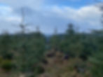
The path took us into a huge coniferous plantation at High Moor which we walked through and uphill to meet a path on the other side of a drystone wall which took us back onto Moorland at Morton Moor (still part of Rombalds Moor).
We passed old stone gate posts looking like Neolithic monuments and headed towards the Ilkley Road which we could see in the distance.

The path went past grouse butts and on the map I became quite excited after spotting at Brass Castle a small circle and the words Stone Circle (Remains of). We explored the field but the remains were long gone and whilst there was a raised earthwork there was nothing of note to see or take a picture of .

When we met the Ilkley Road we turned left. This long straight stretch of road heads up to Whetstone Gate and the Keighley Mast which you can see from miles around. There is only one farm on the road at Bradup and we barely saw a car on our steady two mile climb back up onto Ilkley Moor.
Once on Ilkley Moor the path travels straight across the Moor on a track known as the Keighley Road but now descending, past Cowper’s Cross back to the edge of the Moor in Ilkley. This was an old pack horse route between Wharfedale and Airedale

Cowper’s Cross is believed to have been where a market may have taken place with traders from both valleys. The original shaft to the cross was believed to date back to bronze age times and had various cup and ring markings, but was thought to have been Christianised centuries later with a horizontal piece added to form a cross. The cross was sadly vandalised and what we see now is a recent repaired version with new stone replacing the original upright shaft.
Once back on the edge of the Moor we turned left and soon found the gate to Heber’s Ghyll which we followed back down to our cars.
The cold weather had kept our cans of beer nicely chilled and we celebrated the end of our 9 mile walk with a cold tinnie. A perfect afternoon exploring the Moors.